VR-TheWorld Capabilities
Streaming Terrain for MAK ONE applications
VR-TheWorld is a powerful web-based streaming terrain server that lets you stream in elevation, features, and imagery. It is delivered with a global base map that you can easily populate with your own custom source data through a web-based interface.
Learn all about VR-The World by clicking through the tabs below or download the VR-TheWorld Capabilities document.
VR-TheWorld Streaming Terrain Server
MAK's VR-TheWorld is a powerful web-based streaming terrain server. It is delivered with a global base map, but you can also easily populate it with your own custom source data through a web-based interface. You can deploy the server on private networks to provide streaming terrain data to a variety of simulation and visualization applications behind your firewall. VR-TheWorld stores and streams feature data including roads, buildings, and trees to multiple applications simultaneously. We have continued to expand the amount and quality of imagery and elevation data included with the server while also allowing you to add your own geospatial data to distribute in real-time.
VR-TheWorld Data
To allow customers to try out VR-TheWorld, we host a copy of VR-TheWorld on the internet that anyone can connect to if they have an application that supports WMS-C (including web applications), such as VR-Vantage or VR-Forces. This server shares some common maps and allows you to get a feel for what it is like to use a streaming terrain server. It does not allow you to upload your own content.
VR-TheWorld Is Ready Out-of-the-Box
A VR-TheWorld server is a fully standalone version of VR-TheWorld and can be deployed behind firewalls and security barriers.
VR-TheWorld has over 4 terabytes of global elevation, imagery, and feature data — pre-tiled for high performance access. The VR-TheWorld Basemap has:
- Global elevation. 30 m (DTED Level 2) for the entire globe.
- Sentinel-2 (10 m resolution) cloudless dataset, developed by EOX IT Services GmbH. The dataset modified Copernicus Sentinel data 2020. Available for LOD 0–13. For more details about the EOX Viewing Ready product, visit the EOX IT Services GmbH website (https://eox.at).
- High-resolution inset areas. The insets range from 1 m to 15 cm per pixel – including southern California, Boston, Guam, Switzerland, Washington, D.C., and two airport areas in Afghanistan.
- Maxar Precision 3D samples. 0.5 m imagery and land cover for Schwyz, Switzerland. 0.5 m 3DTiles Digital Surface Model (DSM) for Jalalabad, Afghanistan. https://www.maxar.com/products/precision3d-data-suite.
- Samples of 1:250,000 and 1:100,000 topographic maps in Southern California.
- Highly detailed California map with 2 ft or better imagery.
- Landcover: Global Copernicus 30 m 2019 plus insets for US, Europe, California, Hawaii, and Guam.
- Open Street Map features in MBTiles format.
- A highly detailed map of Hawaii, which includes:
- 15 m Harris Terracolor imagery, added to make the area surrounding the Hawaiian Islands look more like deep blue water. This product has a very nice view of the shallow water boundaries between the ocean and the islands.
- 1 ft USGS Mosaicked Digital Orthophoto Quadrangles (MDOQs) produced through the National Digital Orthophoto Program (NDOP) for the island of Oahu.
- 1 ft water replacement imagery custom built by Harris, including Digital Globe WV2 Imagery blended into Oahu Imagery and Harris Terracolor Imagery to ease the transition between the 15 m and 1 ft imagery.
- 10 m Digital Elevation Model from USGS.
- Feature data for Oahu, including building footprints for 200,000 buildings.
Add Your Own Data
VR-TheWorld comes with an intuitive web interface that makes uploading and organizing your data simple. The web interface walks you through uploading your data and creating new layers from the data. Everything you need to do to serve your own data from VR-TheWorld can be done right from the web interface.
Supported Data Formats
VR-TheWorld supports the following raster file formats:
- MRSID
- GDAL virtual
- Geotiff
- JPEG 2000
- DEM
- DTED 0 - 5
- Arcinfo Binary Grid
- Magellan BLX Topo
- Bathymetry Attributed Grid
- VTP Binary terrain format
- USGS DOQ
- ESRI .hdr
- Envisat Image Product
- ERMapper
- FITS
- Erdas Imagine
- National Imagery Transport Files (CIB, CADRG, and so on)
- BSB Nautical chart format
VR-TheWorld supports the following vector file formats:
- Shape
- Geopackage
- KML
- GPX
- VMAP
- S-57
For performance reasons, VR-TheWorld serves out PNG, TIFF, and JPEG. PNG provides lossless compression of image data and transparency. JPEG provides high level of compression but no transparency. JPEG is recommended for large base layers where transparency is not required. TIFF does not provide compression but supports transparency. TIFF's are recommended for elevation data layers.
VR-TheWorld Serves Feature Data
Features are served using the industry standard WFS protocol.
Integrate Local Data with Served Data
VR-TheWorld customers may want to integrate locally stored data with data served from VR-TheWorld. You could, of course, upload the local data to the server. However, this might not be practical due to the amount of data, security considerations, or other reasons.
You can integrate local and remote data if your application supports the osgEarth earth file format. Create an earth file for the local data and merge it with the earth file for the served data. When you load the earth file in your application, it grabs the data from all the locations specified in the file.
Browser Support
VR-TheWorld supports Microsoft Edge and Google Chrome. No other browsers are tested.
VR-TheWorld Supports WMS-C
The server supports the industry standard WMS-C for streaming imagery and elevation data. This means that clients are not limited to MAK's visualization or simulation tools. Any customer or third-party application that supports WMS-C (including web applications) can access VR-TheWorld immediately. (Of course, MAK ONE products like VR-Forces, VR-Vantage, and VR-Engage support VR-TheWorld.)
VR-TheWorld Provides Management Tools
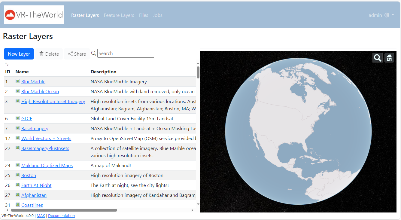
The VR-TheWorld administration interface provides the tools you need to upload and organize your data.

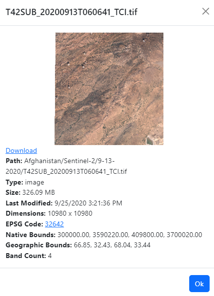
VR-TheWorld can display information about the files in the database, such as the filename, pathname, type, size, and so on.

Data Is Organized in Layers
In VR-TheWorld, data is organized in raster layers and feature layers. You can add and remove layers and specify the files that they contain.

Superior Technical Support
At MAK, technical support is not just an afterthought. Our reputation for supporting our customers is one of the key reasons that people choose our products. When you call or email us with questions, you speak directly to our product developers who know the software inside and out. When you buy MAK's products, you can be sure that MAK will be in your corner as you work towards successful completion of your HLA/DIS project. We've even been known to be on the phone with customers during their HLA certification process, or during key events.
When someone reports a bug, our engineers are quick to provide a patch or workaround, meaning you will not have to wait for the next release to have your problem addressed.
With maintenance, you are entitled to upgrades when they are released.

